TREKK360 helps utilities, municipalities, inspection contractors, engineers, and asset management teams capture better manhole inspection data from the surface.
Whether you are inspecting a handful of structures or managing an entire collection system, TREKK360 gives your team a faster way to capture, review, measure, organize, and share inspection information.
Every team uses inspection data differently. TREKK360 connects those needs through one surface-deployed inspection system and a flexible data workflow.
Field crews need speed and simplicity. No complicated setups, safety procedures, or slow transfers.
Utilities need reliable records, secure cloud storage, and simple remote department sharing.
Engineers need detailed information they can use for rehabilitation planning and structural design.
Contractors need efficient workflows and high-value deliverables that increase profit margin.
Utilities + Municipalities
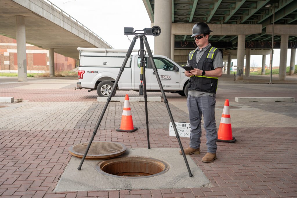
Managing underground infrastructure means understanding asset condition across hundreds or thousands of structures. TREKK360 helps utilities and municipalities build a clearer, more accessible record of their manholes while reducing the need for confined-space entry during visual inspection.
USE TREKK360 TO:
✓
Capture complete 360° inspection footage
✓
Support condition assessment programs
✓
Maintain digital inspection records
✓
Connect inspections to GIS assets
✓
Review structures without returning to the field
✓
Share findings across departments and project teams
✓
Support maintenance and rehabilitation planning
TREKK360 Portal Services can also connect inspection records to live maps, allowing teams to view videos, models, and asset information from mapped locations.
See TREKK360 for Utilities →Inspection Contractors
TREKK360 is designed to help inspection teams move efficiently from one structure to the next. The system weighs under eight pounds when deployed over the manhole, travels in a Pelican case plus a separate tripod sling bag, and can be operated by one person.
A typical inspection can be completed in approximately five minutes, helping crews increase field productivity while capturing a complete digital record of the structure.
USE TREKK360 TO:
✓
Simplify field deployment
✓
Reduce crew requirements
✓
Capture consistent high-resolution footage
✓
Support NASSCO coding workflows
✓
Create higher-value deliverables
✓
Reduce unnecessary return visits
✓
Share inspection results directly with clients
For contractors offering more advanced deliverables, TREKK360 footage can also be processed into measurable 3D models and point clouds.
See the TREKK360 System →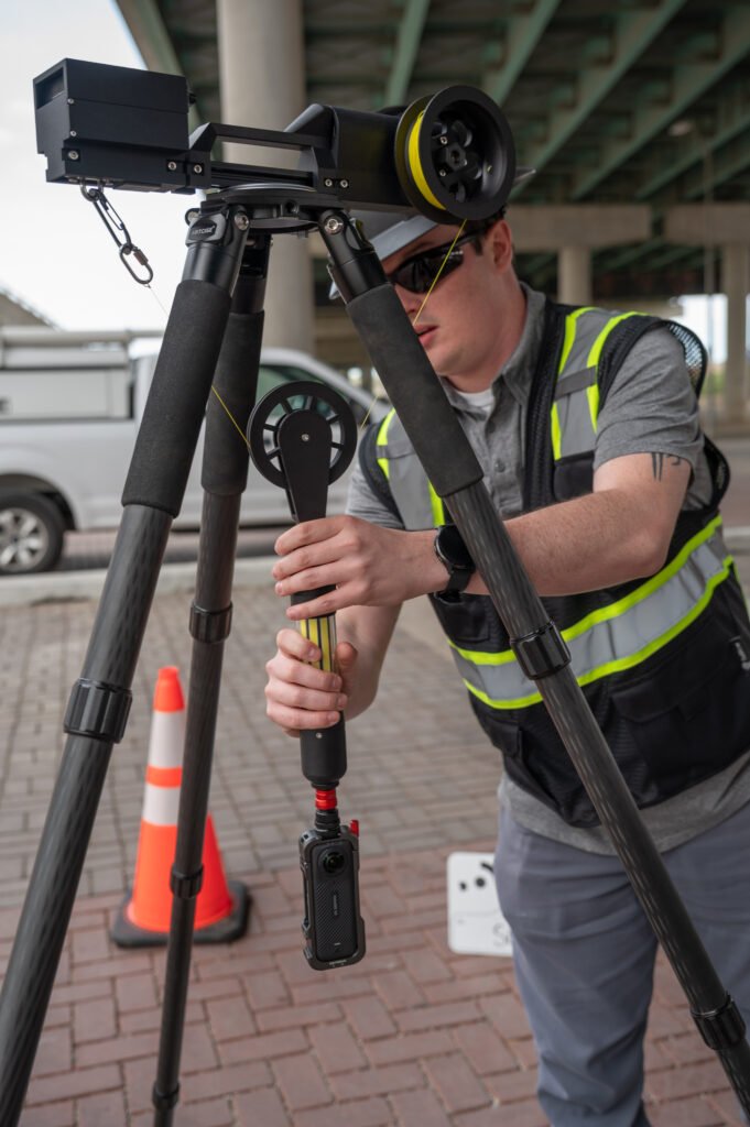
Engineers + Consultants
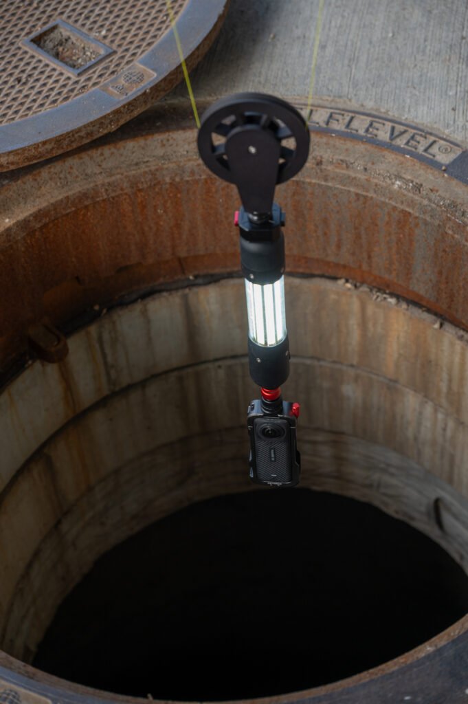
The value of an inspection does not end when the field crew leaves. TREKK360 captures high-resolution footage that can be reviewed later and used as the foundation for measurable 3D models, point clouds, and detailed inspection records.
Engineers can use that information to better understand existing conditions and support downstream project decisions.
USE TREKK360 DATA FOR:
✓
Condition assessment
✓
Rehabilitation planning
✓
Structural review
✓
Defect measurement
✓
Asset documentation
✓
Digital twin development
✓
Project coordination
Processed models can support measurements of cracks, defects, diameters, structural features, and asset components.
Explore Inspection Data + Portal Services →Asset Management + GIS Teams
Inspection information is more useful when it is easy to find, review, and connect to the larger system. TREKK360 Portal Services help teams organize inspection records around the assets they represent.
TEAMS CAN:
✓
Store inspections on a live map
✓
View videos and models from mapped assets
✓
Maintain historical inspection records
✓
Support GIS-based workflows
✓
Share data across departments
✓
Create a more complete digital record of infrastructure
GPS metadata can be linked to GIS maps to help teams access inspection records and models directly from mapped assets.
Explore Portal Services →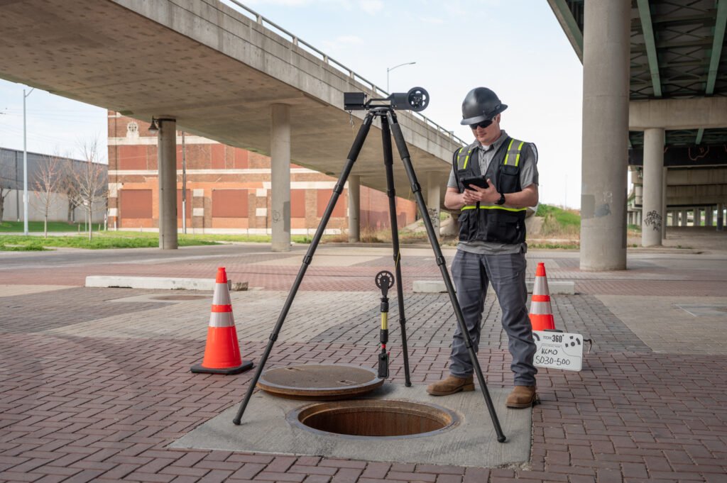
Public Works + Collection System Teams
For teams responsible for routine inspections and long-term system maintenance, TREKK360 provides a repeatable way to capture what is happening below grade. Instead of relying only on field notes or limited imagery, teams can create a permanent 360° visual record that can be reviewed whenever questions arise.
USE TREKK360 TO:
✓
Document existing conditions
✓
Support recurring inspection programs
✓
Identify areas that require additional attention
✓
Maintain consistent records over time
✓
Give office staff access to field conditions
✓
Reduce unnecessary site revisits
Safety + Operations Teams
TREKK360 allows the camera, lighting, and lowering system to enter the structure while the operator remains above grade. For teams focused on field safety and operational efficiency, this provides a way to complete visual inspections without sending personnel into the structure for the inspection phase.
TREKK360 CAN HELP TEAMS:
✓
Reduce direct human intervention in hazardous environments
✓
Simplify inspection operations
✓
Reduce personnel required for visual inspection
✓
Standardize field procedures
✓
Capture a repeatable digital record
Operational Caveat: Physical work such as cleaning, repairs, or lining may still require entry. TREKK360 is designed to reduce entry during the inspection process.
TREKK360 helps bridge the gap between the people collecting inspection data and the people using it. Cloud-based Portal Services allow contractors, engineers, municipalities, utilities, and other stakeholders to review the same inspection information remotely.
01
Capture the inspection quickly and consistently.
02
Access clear 360° footage for condition review and defect coding.
03
Use visual and measurable information for planning and design.
04
Organize inspection records around the assets they represent.
05
Review and share project information without needing to visit the site.
TREKK360 is designed to work with different inspection programs and data needs. Use the system your way.
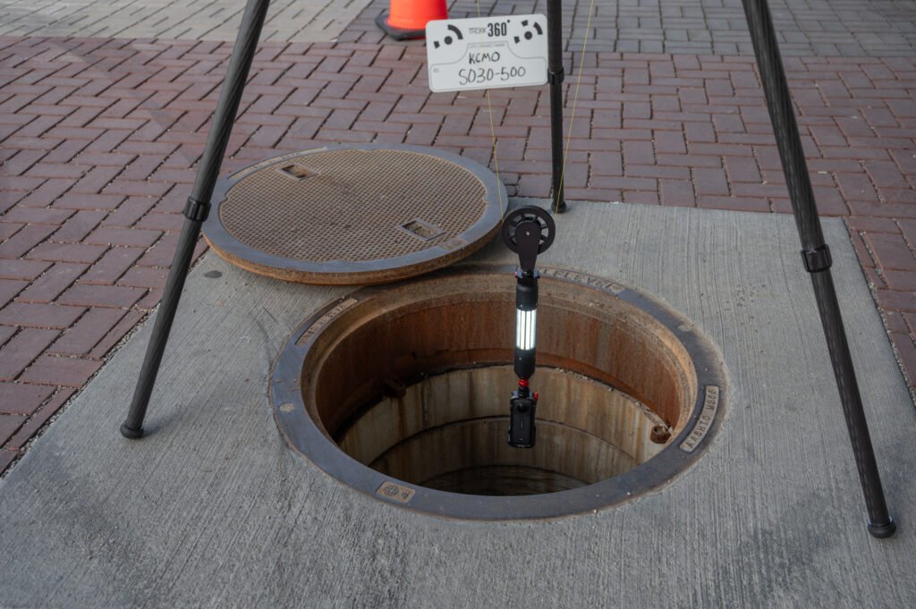
Use the TREKK360 system to collect high-resolution 360° inspection footage quickly from the surface.
Explore the System →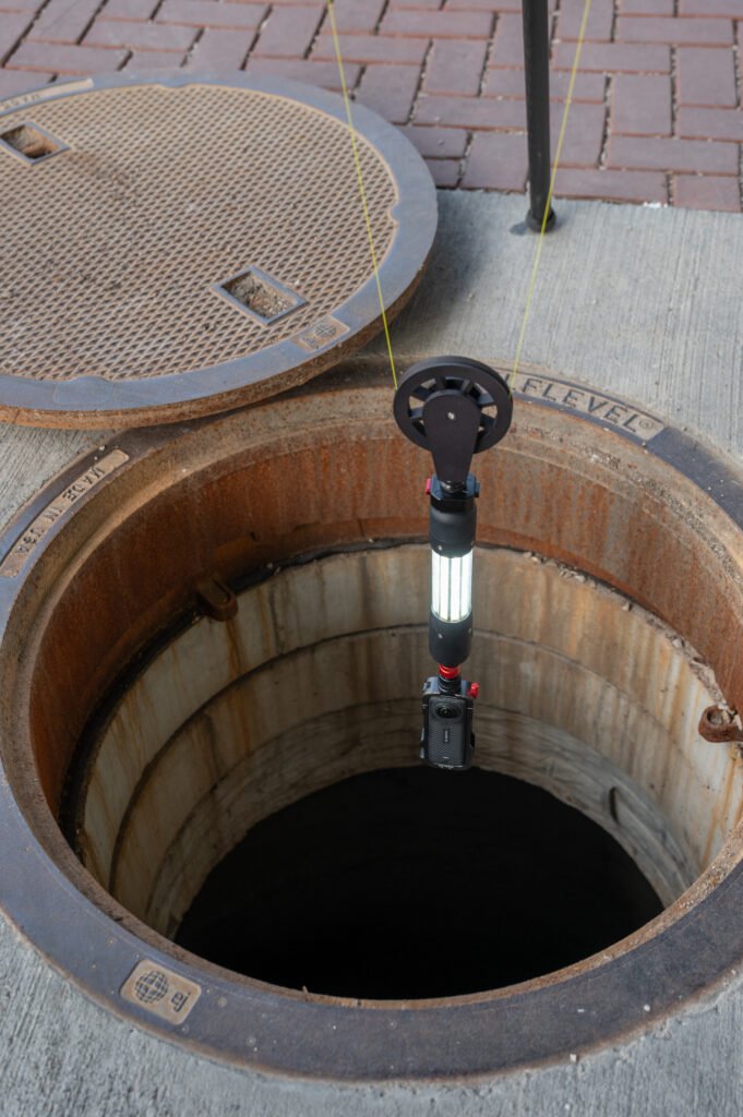
Use TREKK360 footage with your preferred workflow or Portal Services to generate 3D models, point clouds, and measurements.
Explore Portal Services →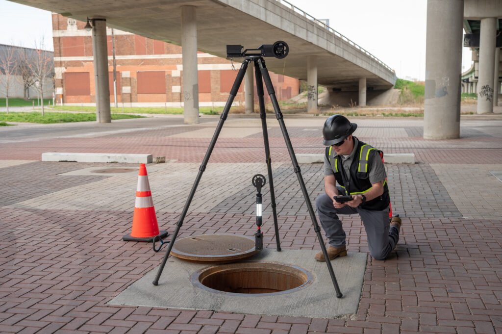
Connect inspection information to GIS and maintain a more accessible digital inspection history.
Explore Data + GIS Capabilities →Every team has different assets, workflows, and deliverable requirements. Talk with us about how your organization currently inspects manholes and what you need from the data afterward. We’ll help you determine where TREKK360 fits.